073 #qgis + #frictionlessdata
Announcing a new release from the cividi team for users of open source mapping

The cividi season of giving started early last year, with the release of a new version of our free and open source Spatial Data Package Plugin for QGIS in mid-December. Here is a recap of the aims of the project and our roadmap going forward.
Originally posted at medium.com/cividi
At cividi we are using Frictionless Data to improve data integrity and validation, as well as a lightweight way of adding and managing metadata like licenses, authors/contributors, and so on. In addition to Python-based Data Science toolkits, we use QGIS as a visual editor to test and analyse geodata. It has a strong open-source community, and supports a large variety of formats with extensive tools to manage, analyse and visualise data in map form.
As a first attempt to combine the two worlds of frictionless open data and open-source GIS, the idea of a simple QGIS plugin to generate Data Packages which containerize GeoJSON using Frictionless Data was born. We developed an initial MVP together with our friends from Finland, the Helsinki-based GIS specialists Gispo OY, who we comissioned to co-develop the project and publish it online in October 2020. We quickly put the plugin into production use over the following months, and have now released a new version that is stabilized and ready for wider use.
We see the core strength of the open web in sharing and collaboration, while native desktop apps allow for feature-rich editing and exploration of self-contained, traceable and timestamped documents. Combining these two worlds is part of our mission to provide a robust framework for open source evidence-based analysis in spatial policy decisions and projects.
Why should I install it
Do you want to share effective spatial visualisations based on open standards with your customers, collaborators or coworkers? The plugin allows you to do just that, with no coding required. You can use open source GIS with spatial Data Packages to:
- publish research results in a spatial context
- tell a story by combining data layers
- upload urban planning projects to juxtapose with data layers
- visualise surveys on a map
- highlight points and areas of interest for a workshop
- and more ...
How do I install it?
Step 1. To install the plugin you will need a recent version of QGIS, the open source GIS application for Linux, Mac and Windows. Head over to qgis.org > Download and grab a copy for your operating system of choice.
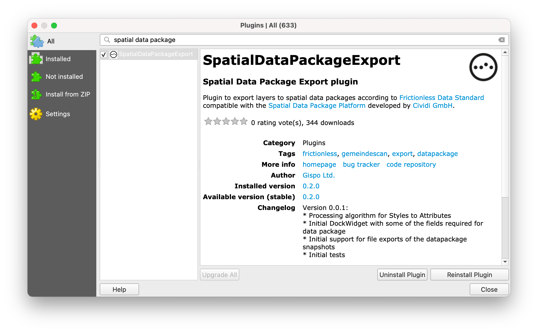
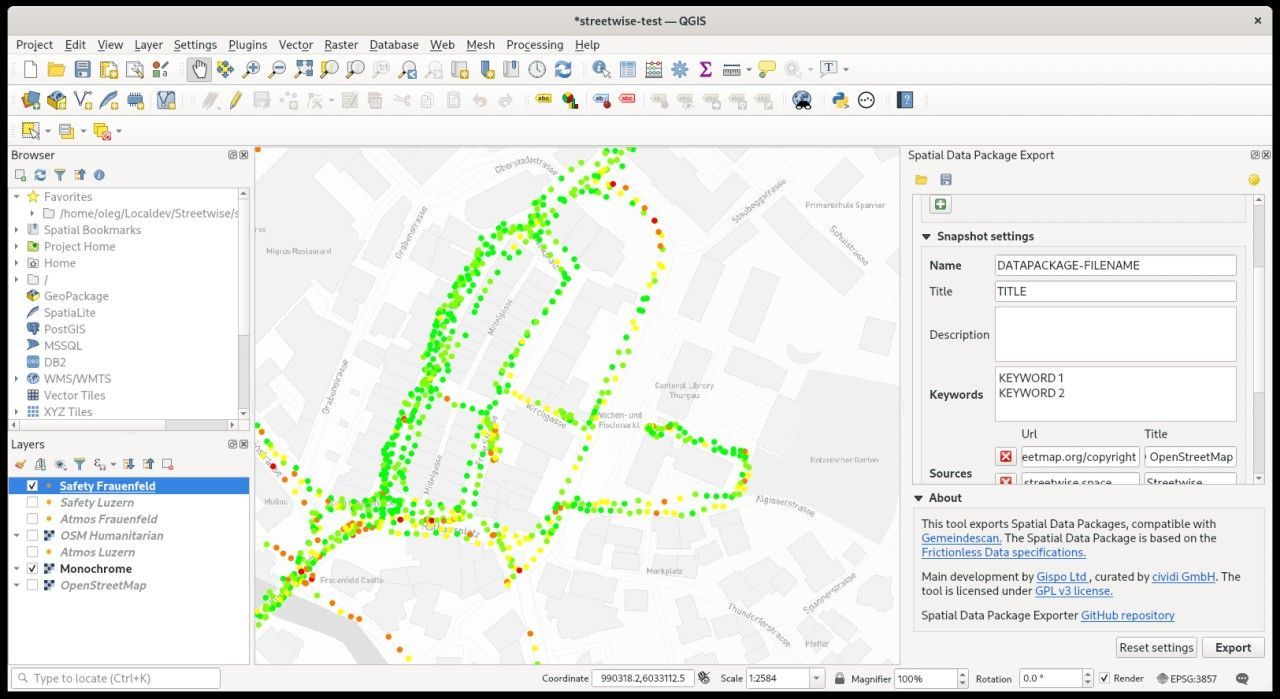
Step 2. Once installed, open QGIS and head to Plugins > Manage and install Plugins, enter Spatial Data Package Export, select the plugin and click on install.
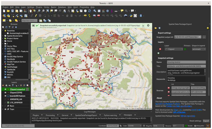
Step 3. Check that the menu option appears in the Plugins menu. A QGIS restart should not be required. You can then start exporting your layers through the plugins GUI. Let us know if you experience any issues.
Why QGIS?
Obviously there is a whole planet of GIS tools out there, and while QGIS and its web-based counterpart QGIS Server are part of our workflow, you might want to see the same feature in a data exploration tool like Kepler.gl, deck.gl, Unfolded and many others. Frictionless Data is a standards-based initiative known for providing libraries for a variety of environments, and we expect to see more tools like this coming out of the community and our own future projects.
What's next?
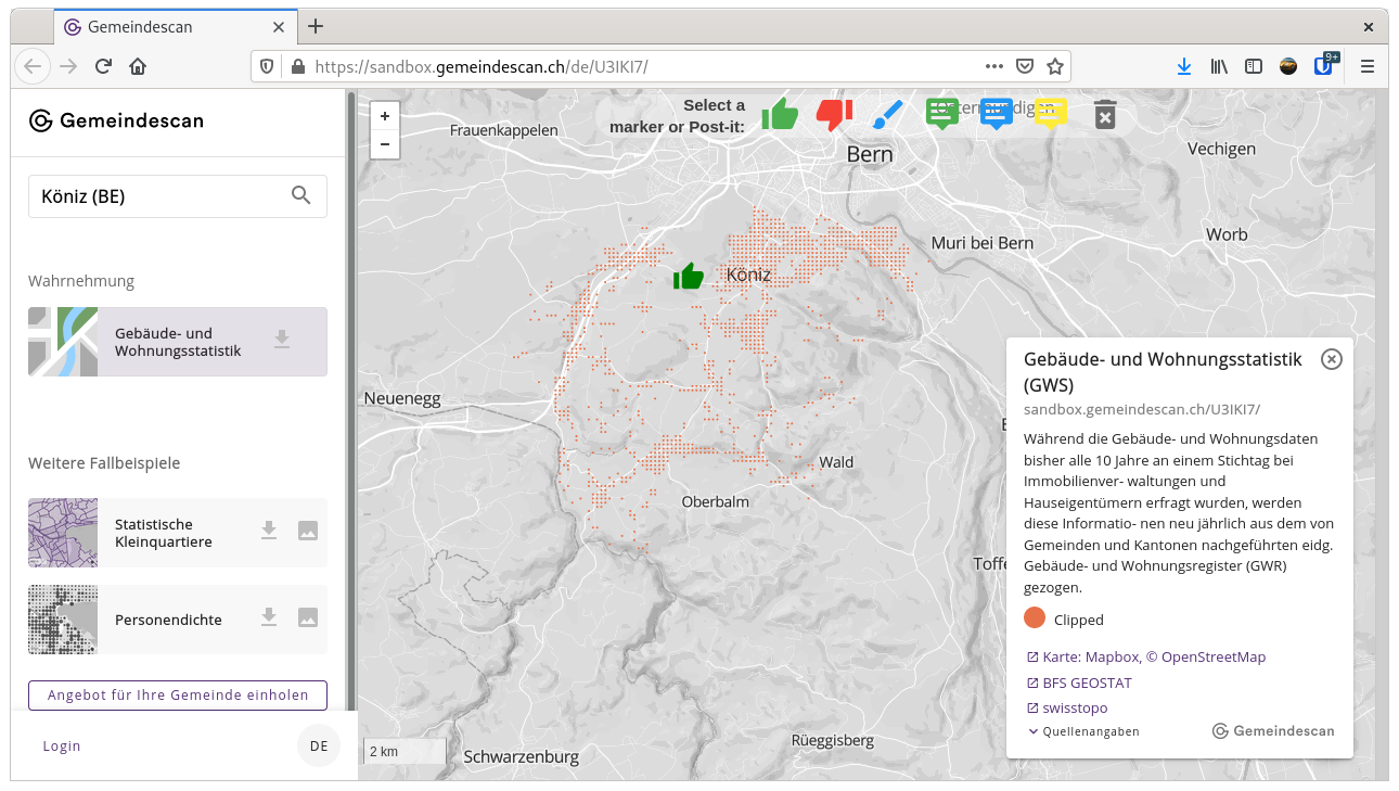
Follow our blog and @cividitech to stay tuned for tutorials on using tools like QGIS and the plugin described here in tandem to creating and publishing your own spatial data packages and snapshots. We will soon introduce you to how to use Gemeindescan.ch for this purpose. Write us a note if you have any questions, or just want to show us your maps!